Saturday, October 26, 2024

Looking for Klang Gate lake views from the hills of Sungai Pusu

Continuing from Klang Gate reservoir lake from Sungai Pusu.


That afternoon, after attending a function at nearby IIUM (International Islamic University of Malaysia) followed by Friday prayer at the university mosque, I decided to check out the hills from yet another part of Sungai Pusu.


I recognised this rough road up the hills from the satellite pictures in Google Map. Despite it was raining I decided to venture on.


At this point I decided to park the car and continue by foot. Luckily I have an umbrella on standby.


As it turned out the rough road leads to an open dumping area up the hills.


Next I followed this trail found via the smartphone hiking apps...


It is the same apps used to get to the nearby reservoir lake. Look at Klang Gate reservoir lake from Sungai Pusu.


I went on until the end of the designated trail and even further. I got to the highest part of these hills.


The reason - to catch good views of the Klang Gate reservoir lake.


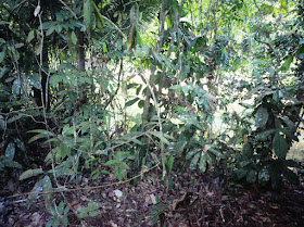
Well, I could only a get some glimpse through the trees at a lower part of the hills, on the way to return to lower ground.


Next, I check out a shorter trail and came across this.


The apps show that I could get to the summit of a lower hill via the trail. But it seems it has been fenced off by some people.


Walking down back to the car via a different route.


At less there are some views of the surroundings available along these trails, although not of the Klang Gate lake. 


Klang Gate reservoir lake from Sungai Pusu

Continuing from Checking up a lake off Sungai Pusu.


Next I when to a housing area up the slopes of a hill at another part of Sungai Pusu.


I learned from a smartphone apps that there is hiking trail accessible from the housing area.


Guided by apps I followed the trail...


Soon I could see a body of water...


This is part of the Klang Gate reservoir lake...


Checking up a lake off Sungai Pusu

Continuing from Looking for views from up a hill at Taman Melawati.


It was around 8 pm or after that I left Taman Melawati to get to Sungai Pusu. After spending the night at the mosque there I decided to make some explorations.


First, I wanted to check out a nearby lake seen in Google Map. For that I have to drive some distance before continuing by foot.


Apparently there is a housing project slated for this area...


The said lake is about 200 metres away from the slated housing project area...


Looking for views from up a hill at Taman Melawati

Peace be upon you. On to activities done over the last 2 days.


Thursday afternoon 24th October 2024. While following Google Map to get to Sungai Pusu from somewhere near Tasik Titiwangsa in Kuala Lumpur I saw a junction to Taman Melawati and decided to take a detour. Next I saw a place marked in Google Map as "Taman Melawati Observation Point". It is located at the summit of the hill seen in front...


I have passed in front of the hill many times.


I've also been up to a part of its slope where lies a row of houses. I used to visit some people around.


But this was the first time I realised there is actually a road leading up to the summit.


It is just it is accessible by car only up to a certain point.


I have to continue the rest of the climb by foot.


Soon I arrived at the summit.


However I found the views around blocked by trees and growth.


Luckily I found another part of the hill which could give superb views of the surrounding. However I could not disclose from which part... :]