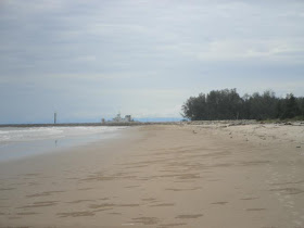
 After walking for some time we could see what lies at the end of the beach...
 There's a long embankment forming some sort of boundary.
 Across is an island which if viewed from the sides or from on top (such as could be seen using Google Earth) would appear almost 10 times as long as the width seen here.
 The island and embankment form some sort of sub-boundary for a vast body of water known as the Brunei bay.
 The bay extends some 40km to Sabah with a sub-bay reaching 25 km inland and 12 km across. Mind you, the land you see towards the horizon is just an island about 3 km from the embankment.


No comments:
Post a Comment