Wednesday, June 10, 2015

Mempawah river from the palace mosque


The journey then brought us to Mempawah more than an hour drive from Pontianak. Within the vicinity of the local palace lies a mosque with superb views of the surrounding. Look at the article Masjid istana Mempawah (Mosque of the palace of Mempawah) in the blogspot SENI LAMA MELAYU (MALAY OLDEN ART).
.


The mosque is situated besides the Mempawah river.


A view upstream...


A view across...


View downriver...


Kapuas river from Batu Layang


After crossing the Landak river we moved 8 km westwards to a place called Batu Layang.


It lies besides the Kapuas river close to an island.


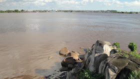
A look across...


A look upstream. The Landak river merges into the Kapuas river about 6 km from here.


Then I was shown a group of stones just 80 metres south-east of the point from where the previous pictures were taken.


I was told these are the stones which gave rise to name Batu Layang.


Batu means stone and Layang could mean kite or glide. It seems the stones evoke the words Batu Layang.


I felt like climbing up to the top of the highest stone. These are the views I got...


Tuesday, June 09, 2015

On to Pontianak city and across...

Continuing from Flight to Pontianak.


Stepping out of the airport I noticed that the hornbill is some sort of venerated symbol around here...


My friend has hired a local driver and soon enough we took off to Pontianak city.


Entering the city border...


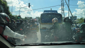
The road seems to get busier as we got closer to city centre...


The main mosque.


The city also has a huge church.


But we did not linger in the city long. We have decided to truly explore it only towards the end of the trip. We wanted to go to other places in West Kalimantan first and so we headed north.


Crossing the Kapuas river...
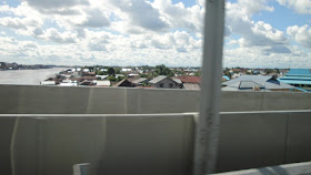


Next, crossing the Landak river...


Flight to Pontianak

Peace be upon you all. Pleased to inform everyone that I am currently on a trip visiting places in the Indonesian province of Kalimantan Barat (West Kalimantan). I've just completed the 2nd day of trip and is currently resting in a hotel at the town of Sambas, about 2 hours drive to the west of the Malaysian border at the state of Sarawak. Since this is the first time I have access to Wi-Fi since starting the trip Monday afternoon I'd like to start sharing stories. Here's the first one...


Monday 8th June 2015. Me and a friend boarded the 11.50 am flight to Pontianak.


It was the first time we were headed for this part of the island of Borneo. I started taking pictures from out of the plane's window when I noticed what seems to be Tanjung Piai in Pontian, Johor, the sourthernmost tip of mainland Asia.


Then thick cloud began to obscure view.


By the time the sky is clear enough all I could see was open sea...


A few minutes later I caught sight of land. It seems we were closing in on the city of Pontianak which I learned later is located 6 hours drive south of Sambas.


I understand the body of water in view is part of the Kapuas river, the longest river in Indonesia.


While the Kapuas river could be seen clearly from the plane I'm not sure if the water seen in this picture is the river. For around here lies another river called Sungai (river of) Landak which flows into the Kapuas within bounds of the city of Pontianak.


Ready for landing...


We have arrived safely. Time to explore what Pontinak and its vicinity has to offer...