Thursday, November 04, 2010

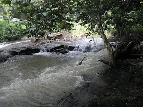
The river besides a stall at Hulu Langat

Further uproad from the Semenyih dam towards Hulu Langat's small town of Pekan Batu 18 lies this roadside stall.


Apart from food and beverage people tend to stop here to rest besides a river.


There's a simple makeshift bridge to cross to the other side.


A look to the right...


A look to the left...


Stopping at Semenyih dam

Continued from A night event at Putrajaya.


The following day, Sunday I went around the Semenyih/Hulu Langat area and stopped at the Semenyih dam.


It's been a while since I passed these parts and this time I brought the wife and baby.


The vast body of water still look impressive.


I won't talk more about this dam. I think I've already said a lot when I made the article Fooling around the Semenyih Dam... 3 years ago.


A night event at Putrajaya

Away from the Brunei stories for a while...


Last Saturday night I went to mid-town Putrajaya and found some going-ons...


There's this sign... GIVE... in front of the Istana Kehakiman or Palace of Justice. What gives? Or rather, give what?


There's plenty of people in yellow...


Ooo... there's a charity event going on. Apparently during the day they had a walk or run...


Anyway as far as I can remember this is the first time I spent sometime at night at these parts of Putrajaya.


Actually I came to rendezvous with some guys. At least there's something to fill the waiting time...


Wednesday, November 03, 2010

Views from the jetty at Muara

Next we went to the ferry jetty complex at Muara, a small town which lies at one end of the Brunei border.


It is located at a part of the Brunei bay which meets the Brunei river.


Officially the Brunei river has its mouth about 13 km south from here, slightly off Pulau Chermin (look at The island called Pulau Chermin). But the way the Brunei bay is formed with a sub-bay around made these parts look like it is still part of the Brunei river, a very wide part that is...


Directly across the jetty lies an island.


To the north lies another island creating a small opening to the open wide waters of the South China Sea. And on the left of the opening is an embankment from which I had viewed the waters around the day before. See Mouth of the Brunei bay/sub-bay?. For the record this is the 600th article in this blogspot.


The island called Pulau Chermin

4th August 2010, after visiting a few other places, we stopped at a part besides the Brunei river where lies this elevated walkway.


It seems there are interesting vistas to be enjoyed...


From here one could get a good perspective of the width of the Brunei river and how it extends into the Brunei bay.


But what interests me most is an island called Pulau Chermin.


Walking to one end of the walkway, I tried to have a closer look.


The island has a place in Brunei's history books when one of its rulers moved his capital here only to find he was caught in a ploy to dethrone him leading to years of civil war. Aside from that I could feel a certain mystical aura surrounding Pulau Chermin. Somehow it reminds me of Pulau Besar in Melaka and I believe this island has much more than what is being told.


Tuesday, November 02, 2010

Mouth of the Brunei bay/sub-bay?

Continued from The beach at Muara.


After walking for some time we could see what lies at the end of the beach...


There's a long embankment forming some sort of boundary.


Across is an island which if viewed from the sides or from on top (such as could be seen using Google Earth) would appear almost 10 times as long as the width seen here.


The island and embankment form some sort of sub-boundary for a vast body of water known as the Brunei bay.


The bay extends some 40km to Sabah with a sub-bay reaching 25 km inland and 12 km across. Mind you, the land you see towards the horizon is just an island about 3 km from the embankment.

Now time to check the embankment...


I went all the way to my satisfaction.


A look behind. Looking at the formation I could say that the embankment began at the mouth of the sub-bay which connects to the Brunei river. Depending on how you see the sub-bay, you could say it is also effectively the mouth of the Brunei river..


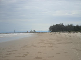
The beach at Muara

Continuing the Brunei stories...


Tuesday 3rd August 2010, my third day in Brunei. After visiting a number of royal tombs we headed for the small town of Muara where lies a beach facing the South China Sea...


It might not be the closest beach to the capital at Bandar Seri Begawan. In fact Muara is quite a distance from the main town.


But there's something I wanted to see. And it is located at the eastern end of this beach. What is it? Look at the coming article. To be continued...