Further down the road I saw another interesting angle of Sungai (river of) Golok.
Take a journey across space and time through the multi-dimensional door that is the soul of my being... For the Salik (Arabic for traveller, also a Sufi term for a searcher) merges in him the raw qualities of an earthly being nicely blended with the divine qualities that belong to Him, the Alpha and Omega of everything.

-----------------------
This blogspot is a medium to share my thoughts and adventures apart from promoting my books. Below are the books which have been written or authored and published by myself.

"Berpetualang ke Aceh: Mencari Diri dan Erti".
ISBN 983-42031-0-1, Jun 2006
"Berpetualang ke Aceh: Membela Syiar yang Asal"
ISBN 983-42031-1-x, May 2007

"Berpetualang ke Aceh: Sirih Pulang ke Gagang?"
ISBN 978-983-42031-2-2, November 2007
It is interesting to note that while these books were written in Malay it has gained enough attention to merit being part of the collections of the American Library of Congress and National Library of Australia. Look here and here.
While the first three books were published by my own company, the fourth titled "Rumah Azan" was published in April 2009 by a company called Karnadya with the help of the Malaysian national literary body Dewan Bahasa dan Pustaka. It features beautiful pictures along with stories behind selected mosques which could be related to the history of Islam and the Malays alongside the formation of the Malaysian nation. Look at the article A collaboration of old collegemates - the book "Rumah Azan".
My fifth book "Ahlul Bait (Family) of Rasulullah SAW and Malay Sultanates", an English translation and adaptation of the Malay book "Ahlul Bait (Keluarga) Rasulullah SAW dan Kesultanan Melayu" authored by Hj Muzaffar Mohamad and Tun Suzana Othman was published early 2010. Look here... My 5th book is out! Ahlul Bait (Family) of Rasulullah SAW and the Malay Sultanates... . For more information check out my Malay blogspot CATATAN SI MERAH SILU.

Like my fourth book "Rumah Azan", the sixth book "Kereta Api Menuju Destinasi" is also a coffee-table book which is published by the company Karnadya with the cooperation of Dewan Bahasa dan Pustaka (the main Malay literary body in Malaysia). Coming out January 2011 it features pictures and stories on the adventure travelling by train to all of Peninsular Malaysia along with the interesting places which could be reached this way.
My seventh book "Jejak keluarga Yakin : Satu sketsa sejarah" in turn is a coffee-table book which is written, editted, designed and has pictures taken by me. Coming out of the factory October 2011, this book which combines family history with history of places such as Singapura, Johor, Batu Pahat, Muar and in fact the history of the island of Java and England has been reviewed with me interviewed live in the program Selamat Pagi Malaysia at RTM1. Look at the article Siaran langsung ulasan buku "Jejak keluarga Yakin : Satu sketsa sejarah" dan temu ramah di Selamat Pagi Malaysia. Some selected contents have been featured in Sneak peek "Jejak keluarga Yakin : Satu sketsa sejarah".
-----------------------

The "Berpetualang ke Aceh" series of novels could be obtained in e-book form. Enter http://www.e-sentral.com/, click general novel and go to page 4. You can also type the word "Aceh" at the search box. Or click straight Book 1, Book 2 and Book 3.
Monday, May 09, 2011
Sungai Golok at 'Point 4'
Sungai Golok at 'Point 3'
Two minutes after leaving Point 2 I arrived at these parts of Sungai (river of) Golok. Let's call it Point 3.
It is so close to the road that I have to just stop and park the car besides and take pictures.
Using the same method of calculations used in the previous article (car travelling at an average speed of 60 kmh) this place should be 2 km further down the road from Point 2. But satellite pictures on Google Earth shows the part closes to the river is only a kilometre from that point. Then I remembered having to stop at the military checkpoint just outside Point 2. That could explain the time lapse...Note: You could see the parts close to the river in the map shown in Sungai Golok at 'Point 2'. Check the bottom part. So there's no need to prepare another map.
Sungai Golok at 'Point 2'
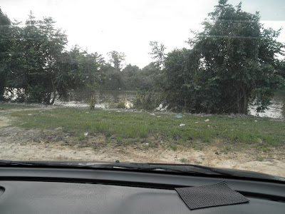
From Pengkalan Kubor I took a rural road which follows the bends and curves of Sungai (river of) Golok upriver towards the town of Rantau Panjang. Except for the occasional distance and trees and suck blocking the view, you could practically see the river all along the way. Came a point I feel I must take propers pictures So I turned right passing 2-3 kampung or village houses and positioned the car facing the river before stepping out.
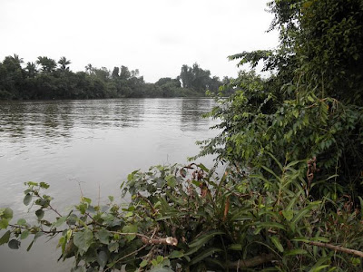
A look downriver. While I don't know the name of the place where I took these pictures or remember the exact point and location I could make a smart guess based on certain factors. Among the factors being I left Pengkalan Kubor and took the junction into this rural road at 6:28pm (it's written in the pictures property) and arrived here at 6:35pm. Taking Sungai Golok at Pengkalan Kubor as shown in the previous article as Point 1 let me mark this place as Point 2.
A look across. Remember it is the country of Thailand seen there. Getting back to the factors, it means it took me 7 minutes since leaving Pengkalan Kubor to get to this place. I believe I was travelling at an average speed of 60 kmh negotiating the twisting and turning road. So this place must be about 7 km from Pengkalan Kubor give and take a kilometer or so.
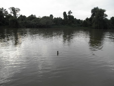
A look upriver. It seems I have made the right guesses and calculations regarding the location of the place.
A check using the tools on Google Earth program shows Point 2 lies across a junction into a smaller rural road. While this trip was close to half year ago I do remember seeing such a junction to my left but taking a small path to the right to get close to the river. There was a military check point near that junction and I believe what I've surmised here tallies with the actual experience.
Sungai (river of) Golok at Pengkalan Kubor
This is the Pengkalan Kubor immigration complex which lies at the northern border of the state of Kelantan.
Normally you could only get pass these parts with a valid passport and ferry ticket.
But ask nicely and they could let you go walk to the jetty. After all it is not against the law, unless you stepped into a boat to get across without a valid passport and a ticket.
For here lies Sungai (river of) Golok which forms the national border between the countries of Malaysia and Thailand. A look to the right, a look downriver and you can see the part of the river curving up north entering the South China Sea.
A look across and you can see the small Thai town of Takbai, a popular entry point for those intending to go to the region of Patani from Kelantan.Saturday, May 07, 2011
Enjoying the breeze at Pantai Sri Tujuh
Next we went further up north and reached a place called Pantai Sri Tujuh.
It is actually the name of a beach (pantai = beach).The waters near Tumpat
Not far from the train station lies a recreational field and this hut.
Upon closer examination in turns out to be a platform facing a body of water.
A look to the right. It looks like a river.
A look ahead. The land across could be an island. I'm not sure but these parts of Tumpat could still be an extension of the Kelantan river delta. Crosscheck with the article Going around the Kelantan river delta made yesterday.Tumpat train station in daylight
We then went to Tumpat train station.
Last year I went here with a photographer to make a book on a train travelling. But we arrived from Kuala Lumpur at night and tight schedule meant we have to catch the earliest train the following day which left early morning still in the dark. Look at the old articles On to Tumpat, the furthest point on the East Coast route and Kelantan stations early morning.
So in this visit I took the opportunity to have a good look at it in daylight.A quick look at the town of Tumpat
Soon we arrived at the town of Tumpat.
It is a small town about 17 km by road north-west of the city of Kota Bahru.
Friday, May 06, 2011
'Facing' death at Tok Selehor's special meditation hole
Within the graveyard area also lies a certain building.
It is a special place, a remnant from the time of Tok Selehor when a certain way of meditation was practised to allow pupils to have a peek at the universe' hidden realities.
What realities are we talking about? For one it is about life after death.
For inside this building lies a hole.
It goes down 6 to 8 feet or so reaching the same underground level as the deceased buried.
This is no joke. Only a few feet of dirt and ground separates us from the actual remains of the dead. This is how it looks in the darkness. And this was still daytime.
A picture with flash. Baby Al-Rasyid was getting agitated having been forced to sit still for this shot. Notice the sloped area to the right. That's when pupils used to lie in silent meditation just like the dead. If your lucky (or unlucky? Depends really on how you see the supernatural) you could have the experience of seeing with your very own eyes the coming of two angels sent specially for questioning your deeds on earth. And what happens next, whether it is scary or beautiful depends on how you did upon examination. No joke. I understand it is practically a glimpse of paradise or hellfire... 


