-----------------------

This blogspot is a medium to share my thoughts and adventures apart from promoting my books. Below are the books which have been written or authored and published by myself.


"Berpetualang ke Aceh: Mencari Diri dan Erti".

ISBN 983-42031-0-1, Jun 2006


"Berpetualang ke Aceh: Membela Syiar yang Asal"

ISBN 983-42031-1-x, May 2007


"Berpetualang ke Aceh: Sirih Pulang ke Gagang?"

ISBN 978-983-42031-2-2, November 2007


It is interesting to note that while these books were written in Malay it has gained enough attention to merit being part of the collections of the American Library of Congress and National Library of Australia. Look here and here.


While the first three books were published by my own company, the fourth titled "Rumah Azan" was published in April 2009 by a company called Karnadya with the help of the Malaysian national literary body Dewan Bahasa dan Pustaka. It features beautiful pictures along with stories behind selected mosques which could be related to the history of Islam and the Malays alongside the formation of the Malaysian nation. Look at the article A collaboration of old collegemates - the book "Rumah Azan".


My fifth book "Ahlul Bait (Family) of Rasulullah SAW and Malay Sultanates", an English translation and adaptation of the Malay book "Ahlul Bait (Keluarga) Rasulullah SAW dan Kesultanan Melayu" authored by Hj Muzaffar Mohamad and Tun Suzana Othman was published early 2010. Look here... My 5th book is out! Ahlul Bait (Family) of Rasulullah SAW and the Malay Sultanates... . For more information check out my Malay blogspot CATATAN SI MERAH SILU.


Like my fourth book "Rumah Azan", the sixth book "Kereta Api Menuju Destinasi" is also a coffee-table book which is published by the company Karnadya with the cooperation of Dewan Bahasa dan Pustaka (the main Malay literary body in Malaysia). Coming out January 2011 it features pictures and stories on the adventure travelling by train to all of Peninsular Malaysia along with the interesting places which could be reached this way.


My seventh book "Jejak keluarga Yakin : Satu sketsa sejarah" in turn is a coffee-table book which is written, editted, designed and has pictures taken by me. Coming out of the factory October 2011, this book which combines family history with history of places such as Singapura, Johor, Batu Pahat, Muar and in fact the history of the island of Java and England has been reviewed with me interviewed live in the program Selamat Pagi Malaysia at RTM1. Look at the article Siaran langsung ulasan buku "Jejak keluarga Yakin : Satu sketsa sejarah" dan temu ramah di Selamat Pagi Malaysia. Some selected contents have been featured in Sneak peek "Jejak keluarga Yakin : Satu sketsa sejarah".


-----------------------


The "Berpetualang ke Aceh" series of novels could be obtained in e-book form. Enter http://www.e-sentral.com/, click general novel and go to page 4. You can also type the word "Aceh" at the search box. Or click straight Book 1, Book 2 and Book 3.


Friday, January 15, 2010

Tanjung Pengelih, entry-point to the Riau islands

From Sungai Rengit we drove some 16 km to the west to get to a cape called Tanjung Pengelih. From here there is no mistaking the land across as the island of Singapura. The skyscrapers in the distance could not belong to any other except its city-centre skyline...


Here there exist a main navy camp. Then again it is out of bounds to us civilians...

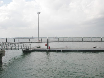
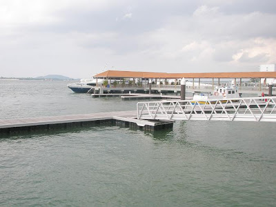
Next place to go is the jetty of Tanjung Pengelih...


It is for boats or ferries plying the route to the Indonesian island of Batam, known to be a sort of weekend hideaway for some...


Across the jetty one could see the island of Pulau Tekong belonging to Singapura...


I understand works have been going for years to reclaim land around Pulau Tekong and make it closer to the Singapura main island, a process that has somehow constricted flow of waters of the Straits of Tebrau which divides Singapura from Johor.


From Tanjung Pengelih it is only 20 km down straight south to the island of Batam. For the record, Batam is part of the group of islands called the Riau islands which is very famous in old Malay history for being the centre of seat for the Bugis dynasty comprising descendants of the famous 5 Bugis princes, Daeng Parani, Daeng Merewah, Daeng Menambon. Daeng Kemasi and Daeng Chelak. The islands included Bintan (also known as the island of Bentan) and are part of Indonesia. Thus while the cape is some distance by road from the main Johor city of Johor Bahru, its small distance from Indonesia makes it an ideal entry or embarkation point.

Sungai Rengit of Kota Tinggi, the southern-most point of east Johor

From Desaru we head south past Teluk Ramunia and on to Sungai Rengit...

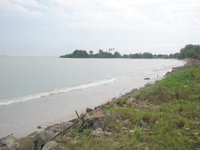
Like at Desaru you can have a good view of the South China Sea. But here it is much closer to the island-nation of Singapura... not the island in the picture though...


Here's one directly to the south with a view of the ships anchored off Singapura. When I took this picture I thought it was Singapura in the background but a check with Google Earth shows that it is either the island of Batam or Bintan in Indonesia.


A look to the west...


And on we go to the small town of Sungai Rengit.


This one nearly got me spooked...


Anyway did I tell you that Sungai Rengit is the southern-most point of east Johor? Well, I've been told that by some people but a check using Google Earth shows a cape 3 km to the south-west as the actual southern-most point. That again you could say it is still part of Sungai Rengit. So I guess the claim still holds...


Desaru from one of its best resort

After Singapura we went to the Johor district of Kota Tinggi to spend the night at one of the best hotel resort in the beach of Desaru...


While the facilities here are superb we don't have much time to enjoy it as there were still other places to go...

So apart from the little sleep we got, breakfast and lunch we only have time for a quick look about...


Oh, we stayed at one of the rooms at the top floor up there...


Here's a view of the beach...


Desaru offers miles and miles of white sand. The last time I was here was when I made a solo biking trip across Peninsular Malaysia at the end of 1997...


I can't remember if I took a dip then. If not, then the last time I've ever immersed myself in these waters was probably sometime in the 1980s. So there... if not because of the time constriction, I would definitely take a dip even though the waves were pretty strong.


What could I say? Thank God at least the view was worth the while...


Wednesday, January 13, 2010

Singapura city at night...

As I drove around the city of Singapura at night, I just couldn't help taking in the view...


I've always love the cityscape with lots of light...

And Singapura city has plenty of that.


Why, I even parked my car by the roadside as the wife and baby waited inside while I walked around to savour the sight.


Again I'd say what Singapura have Malaysia especially the city of Kuala Lumpur also have. What makes the difference is each city's own unique charateristics. And the arrangement of buildings and skyscapers in Singapura is enough reason to admire it on its own...


Tuesday, January 12, 2010

The skyline of Singapura

One thing impressive about the city of Singapura is its skyline full of skyscrapers...


The highway system is also good but frankly I don't think it could beat what is available in Kuala Lumpur nowadays.

Still, the city has its own flavour...


Before the 1990s, you could say Singapura is leaps and bounds ahead of Kuala Lumpur and the rest of Malaysia. Now since the 450 plus metres high twin towers of Petronas and almost as high Telekom Tower at Bukit Nenas were in view, I'd say there's nothing that Singapore have which KL couldn't beat except maybe in the way their people are known to be kiasu...


Anyway stop comparing already. We arrived in Singapura when the streets were practically painted red in preparation for the Christmas season. So let us all be at peace with each other. Cheers all! :]


The view from Mount Faber

This is the cable car station at Mount Faber...


Connecting mainland Singapura to the resort island of Sentosa, you could catch some breathtaking views here...

There, parts of Sentosa across the waters...


Here's view of Sentosa from another part of Mount Faber towards the peak...


Nearing the peak. At 105 metres high from sea level it might look like a knoll to some. Still Mount Faber which used to be known as Bukit Teluk Belanga is the highest peak in Singapura...


As such, it offers some of the best views in and of town, or rather the city...


The railway station at Tanjung Pagar

OK. This is a railway station at Tanjung Pagar, at the western fringe of Singapura city centre...


For the record this railway station belongs to KTMB (Keretapi Tanah Melayu Berhad), the government-linked railway company of Malaysia.


Actually it's the southernmost railway station operated by KTMB. From here one could take a railway to Kuala Lumpur some 400 km to the north and go straight another 400km to Padang Besar in Kedah before entering Thailand. One could also take the forking path at Gemas heading north-east to Kelantan through Pahang.


This railway station is a remnant of the days went Singapura was part of Malaysia...


Now it is a reminder that the island, despite Singapura's at times harsh attitude towards Malaysia still remains a part of the overall concept of Tanah Melayu despite its overwhelming Chinese population or any claims to the contrary.


The road to Singapura

From Pontian we went to Johor Bahru before spending the night in Pulai. The next day , Tuesday we start to make way to the island-state of Singapura, the major destination in our trip to the south.


We wanted to enter Singapura through the second link at Tuas...


Since we started from Pulai, we have to re-enter the district of Pontian first...


For it is from there we could enter into the highway leading to the second link...


This is the highway...


Soon enough we arrived at the Malaysian check-point...


Now begin the journey to cross over the Straits of Tebrau into Singapura.


At the middle of the bridge I couldn't help but stop to take pictures...


Could be seen here Singapura lying to the right while mainland Johor is to the left...


Here are views from the opposite lane...


At the other end of the bridge lies the Singapura check-point...


And soon we were inside the island-state. To be continued...