-----------------------

This blogspot is a medium to share my thoughts and adventures apart from promoting my books. Below are the books which have been written or authored and published by myself.


"Berpetualang ke Aceh: Mencari Diri dan Erti".

ISBN 983-42031-0-1, Jun 2006


"Berpetualang ke Aceh: Membela Syiar yang Asal"

ISBN 983-42031-1-x, May 2007


"Berpetualang ke Aceh: Sirih Pulang ke Gagang?"

ISBN 978-983-42031-2-2, November 2007


It is interesting to note that while these books were written in Malay it has gained enough attention to merit being part of the collections of the American Library of Congress and National Library of Australia. Look here and here.


While the first three books were published by my own company, the fourth titled "Rumah Azan" was published in April 2009 by a company called Karnadya with the help of the Malaysian national literary body Dewan Bahasa dan Pustaka. It features beautiful pictures along with stories behind selected mosques which could be related to the history of Islam and the Malays alongside the formation of the Malaysian nation. Look at the article A collaboration of old collegemates - the book "Rumah Azan".


My fifth book "Ahlul Bait (Family) of Rasulullah SAW and Malay Sultanates", an English translation and adaptation of the Malay book "Ahlul Bait (Keluarga) Rasulullah SAW dan Kesultanan Melayu" authored by Hj Muzaffar Mohamad and Tun Suzana Othman was published early 2010. Look here... My 5th book is out! Ahlul Bait (Family) of Rasulullah SAW and the Malay Sultanates... . For more information check out my Malay blogspot CATATAN SI MERAH SILU.


Like my fourth book "Rumah Azan", the sixth book "Kereta Api Menuju Destinasi" is also a coffee-table book which is published by the company Karnadya with the cooperation of Dewan Bahasa dan Pustaka (the main Malay literary body in Malaysia). Coming out January 2011 it features pictures and stories on the adventure travelling by train to all of Peninsular Malaysia along with the interesting places which could be reached this way.


My seventh book "Jejak keluarga Yakin : Satu sketsa sejarah" in turn is a coffee-table book which is written, editted, designed and has pictures taken by me. Coming out of the factory October 2011, this book which combines family history with history of places such as Singapura, Johor, Batu Pahat, Muar and in fact the history of the island of Java and England has been reviewed with me interviewed live in the program Selamat Pagi Malaysia at RTM1. Look at the article Siaran langsung ulasan buku "Jejak keluarga Yakin : Satu sketsa sejarah" dan temu ramah di Selamat Pagi Malaysia. Some selected contents have been featured in Sneak peek "Jejak keluarga Yakin : Satu sketsa sejarah".


-----------------------


The "Berpetualang ke Aceh" series of novels could be obtained in e-book form. Enter http://www.e-sentral.com/, click general novel and go to page 4. You can also type the word "Aceh" at the search box. Or click straight Book 1, Book 2 and Book 3.


Friday, November 26, 2010

Tribute to the August Brunei trip

Now that the Brunei stories have been completed, let's gather all the links for everyone to follow and read. As readers might probably know, articles were made on all three of my blogspots. As it turns out there are a total of 72 articles for the trip made early August. This is it...


1. Salam dari Brunei...

2. Tiga kali ke Brunei dalam seminggu... melalui udara, laut dan darat

3. 'Buah tangan' dari Brunei

4. Lawatan tak dijangka ke Brunei - Sebab musabab perjalanan, institusi Melayu Islam Beraja.

5. Masjid (Mosque of) Omar Ali Saifuddin, Brunei

6. Views of Brunei's golden-domed mosque and its surroundings

7. Makam (Tomb of) Sultan Syarif Ali

8. Makam (Tomb of) Syarif Adam.


14. Lawatan tak dijangka ke Brunei - Mengkaji salasilah di Muzium Brunei dan keindahan makam di Luba...

17. Masjid jamek (Main mosque of) Hassanil Bolkiah.

18. Makam (Tomb of) Sultan Husin Kamaluddin .


20. The beach at Muara

21. Mouth of the Brunei bay/sub-bay?

22. Lawatan tak dijangka ke Brunei - Mencecah air muara

23. Kota Batu, pusat pemerintahan lama Brunei (the old ruling centre of Brunei)

24. Tapak (Site of) Kota Batu I

25. Perkuburan lama (Old graveyard of) Kota Batu

26. Makam (Tomb of) Sultan Bolkiah.

27. Muzium Teknologi Melayu (Malay Technology Museum), Brunei.

28. The island called Pulau Chermin

29. Masjid (Mosque of) Setia Ali, Muara.

33. An early look at the town of Labuan

34. Makam (Tomb of) Syarif Kedah.

35. Lawatan tak dijangka ke Brunei - Ke Labuan dan makam Syarif Kedah

36. Masjid jamek (Main mosque of) Labuan

37. The cape called Tanjung Batu

38. Visiting the Chimney at Tanjung Kubong.

39. The beach called Pantai Batu Manikar.

40. Saying goodbye to Sharif Kedah.

41. Muzium (Museum of) Labuan.

49. Family kenduri at Seria

50. The waters off Brunei's Lumut.

51. One Billionth Barrel Monument.

52. Lawatan tak dijangka ke Brunei - Kawasan kaya minyak di Seria

53. The town of Seria

55. Masjid jamek (Main mosque of) Miri

56. Lawatan tak dijangka ke Brunei - Sampai ke bumi kenyalang, cukup semua 13 negeri dijejaki...

57. The river that gives name to Kuala Belait

58. South China Sea from Kuala Belait.

59. The coastal road from Kuala Belait to Seria.

62. Makam-makam lama di (Old tombs at) Kianggeh.

63. The market of Tamu Kianggeh.

64. Boat ride at Kampung Ayer

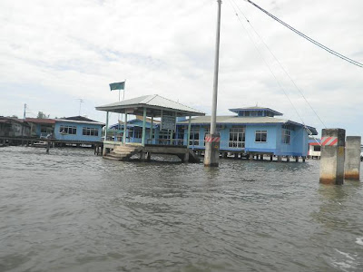
65. Boat ride at Kampung Ayer continued....

66. Galeri kebudayaan dan pelancongan Kampong Ayer (Kampong Ayer cultural and tourism gallery)

67. Views from the tower at Kampung Ayer

68. Tamu Kianggeh from the boat.

69. Bangunan Alat Kebesaran Diraja (Royal Regalia Building), Brunei.

70. Masjid Pengiran Mahkota Muhtadee Billah (Mosque of Crown Prince Muhtadee Billah).

71. The flight return from Brunei

72. Lawatan tak dijangka ke Brunei - Kesibukan hari terakhir


Thursday, November 25, 2010

The flight return from Brunei

OK. The last 5 articles were all made today Thursday to show the activities done on Sunday while I was in Brunei with the wife and baby two and a half-month ago. There were also other places visited which I don't mention in this blogspot but suffice to say I made a lot of stops because it was our last day there.

Oh. Have I mentioned about it being the last day? If not let me just say that Sunday 8th August 2010 we only have a few more hours to explore and by 4 pm we were already taking off.


Originally I wanted to write this article with every picture taken compared against simulated terrains produced by the programme Google Earth using satellite pictures.


But after preparing and writing 10 articles so far today I felt too tired to do that.


So let these pictures suffice. At this juncture we were following the coastal path from Tutong to Seria on to Kuala Belait.


Here we could already see Kuala Belait, the westernmost town of Brunei with a snaking river in the background, the river Baram being part of the Malaysian state of Sarawak.


Down below we could see oil platforms and ships.


Ah. The mouth of the Baram river, an area called Kuala Baram is already in view. The city of Miri should be in the middle of this picture.


From here onwards the plane started to directly cross the South China Sea.


It was only sometime later that I began to see land.


This came in the form of the Indonesian islands known as Natuna kecil, the smaller Natuna.


According to the maps there should be a bigger Natuna island before but I seemed to have missed it. Luckily I didn't miss the popular Malaysia island called Pulau Tioman.


It was not long before we enter the airspace of Peninsular Malaysia.


I've taken a number of pictures for reference but let's just move on to the legendary mountain called Gunung Ledang.


At this juncture I could see we were crossing the main mountain range of Banjaran Titiwangsa somewhere near the Negeri Sembilan state capital, Seremban.


Soon we could see the Straits of Melaka in the background. This means we were about to land. Enough stories from the Brunei trip ya! Hope everyone enjoyed what have been dished so far. :]


Tamu Kianggeh from the boat

In the article The market of Tamu Kianggeh I've mentioned about noticing that the market could be accessed directly by boat.


Well after having a fulfilling boat ride on the waters of the Brunei river and enjoying a good look at the water village Kampung Ayer I asked the boat rider if he could take us up the smaller Kianggeh river.


He was happy to oblige.


And so there we were up this tributary of the Brunei river.


The market of Tamu Kianggeh was soon in view.


Interesting this steps to get on land... they have poles that reminds one of Venice, not that I've been there although I've been to parts of Italy...


And here we could see the bridge taken when we first stepped foot on the market.


The boat driver made a turn.


Time to head back to the Brunei river. For we could have landed at Kianggeh if we wanted. But we left our car on the banks of the bigger river remember?


Views from the tower at Kampung Ayer

Continued from the previous article, Boat ride at Kampung Ayer continued....


At Kampung Ayer we stopped at a cultural gallery where lies a viewing tower.


After exploring the gallery we immediately went up the tower.


The tower provides vantage views of the surroundings. Here we should be looking to the west with parts of the Bruneian capital of Bandar Seri Begawan seen to the right.


A look to the south-west and the water village of Kampung Ayer begans to fill the view.


Take a close-up look and you could see Istana Nurul Iman, the Brunei Sultan's palace in the background.


I continued making turns anti-clockwise, each time at 30 degrees or so...


Here we can see the gallery building.


The jetty to get to the gallery.


Bandar Seri Begawan.


For the record this is the 626th article in this blogspot. Just to remind myself, that's 313 x 2... :]


Boat ride at Kampung Ayer continued...

The boat ride continued past the water village's western boundary where you can get a good view of Istana Nurul Iman, the main palace of the Sultan of Brunei.


Then it started making a turn.


This is done to see the parts of Kampung Ayer on the opposite side of the Brunei river.


The pictures in the previous article only show the side along Bandar Seri Begawan.


If that side of Kampung Ayer is 1 km long this one across is twice as long.


Kampung Ayer is actually a blanket name covering a number of separate water villages.


Mind you there is even a connecting longer but narrower stretch of water villages after a bend downriver. But here let us concentrate on the parts facing Bandar Seri Begawan.


As told in the previous article, I've taken around 100 pictures on this boat ride alone along these parts. Obviously I can't show all...


If I remember correctly Kampung Ayer is touted a the biggest water settlement on earth.


Given the vast area covered watching schools, community halls on water and such I'm not surprised if that is true.


Why, they even have a full-fledged mosque around here...


I've covered not even 50 per cent of these parts of Kampung Ayer what more the longer stretch down the Brunei river bend. Who knows what else they have there...